|
New Orleans City Park (Images of America) |
|
|
Acquisitions |
||
|
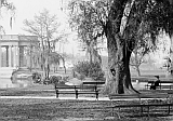
 An 1855 ordinance mandated that the Chief of Police appoint one officer to patrol the park to prevent destruction
of trees. Ordinances in 1858 called for the selection of a caretaker, the building of a keeper's lodge, and the authorization
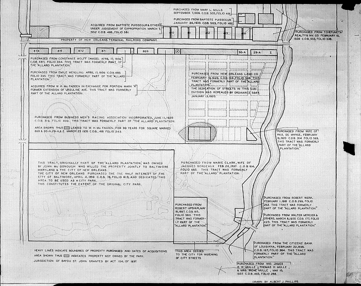
to contract for fencing along Metairie Road. The park officially opened in 1859. This diagram shows land acquisitions from
1859 through 1939. Note that the original park extended only along Metairie Road to the Orleans Canal (McDonogh's land also
extended west of Orleans Avenue but was never used for the park) to just south of what is now the stadium and west of NOMA.
The park expanded eastward until 1918, not to grow northward until the 1920s when city streets were taken. The largest acquisition
(900 acres) extended and improved by the WPA during the 1930s and 1949s is not included here. (NOPL) : :
|
|
|
The images in this book appear courtesy of the New Orleans Public Library (NOPL), Louisiana Digital Library (LDL), the Library of Congress (LOC), The Historic New Orleans Collection (HNOC), Pictometry International (PI), and D.C. "Infrogmation" May (DCM). Unless otherwise noted, images are from the author's collection.
|
||