|
New Orleans City Park (Images of America) |
|
|
Bayouc Choupic |
||
|
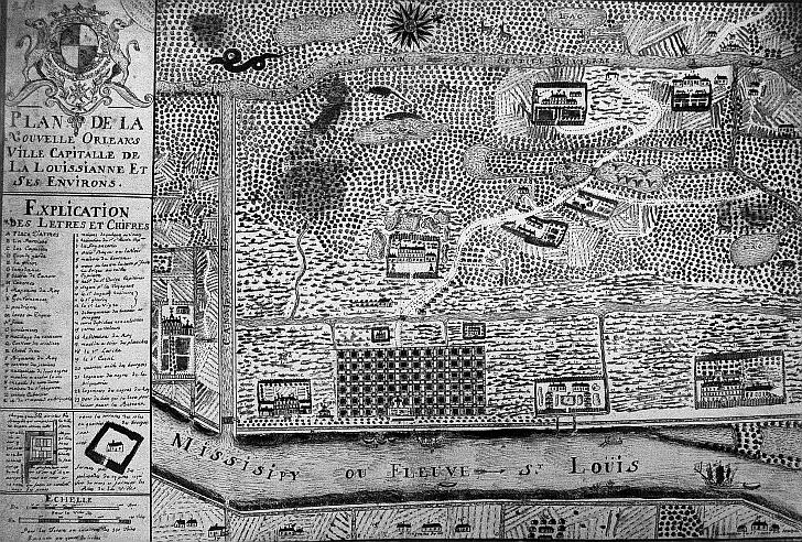
du Pratz later “proceeded to the Bayouc Choupic [Bayou Metairie] so denominated from a fish of that name
abounds not only with sea fish but with fresh water fish, some of which, particularly carp, would appear to be of a monstrous
size in France. We entered this Creek Choupic: at the entrance of which is a fort at present [included in this illustration].
We went up this creek for the space of a league, and landed at a place where formerly stood the village of the natives, who
are called Cola-Pissas...that is, the nation of men that hear and see. From this place to New Orleans, and the river Missisippi,
on which that capital is built, the distance is only a league”. Below is a 1930s view of the Dueling Oak, which stood
when du Pratz settled there, and the Dreyfous Bridge. (LDL) : :
|
|
|
The images in this book appear courtesy of the New Orleans Public Library (NOPL), Louisiana Digital Library (LDL), the Library of Congress (LOC), The Historic New Orleans Collection (HNOC), Pictometry International (PI), and D.C. "Infrogmation" May (DCM). Unless otherwise noted, images are from the author's collection.
|
||