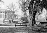
New Orleans City Park (Images of America)
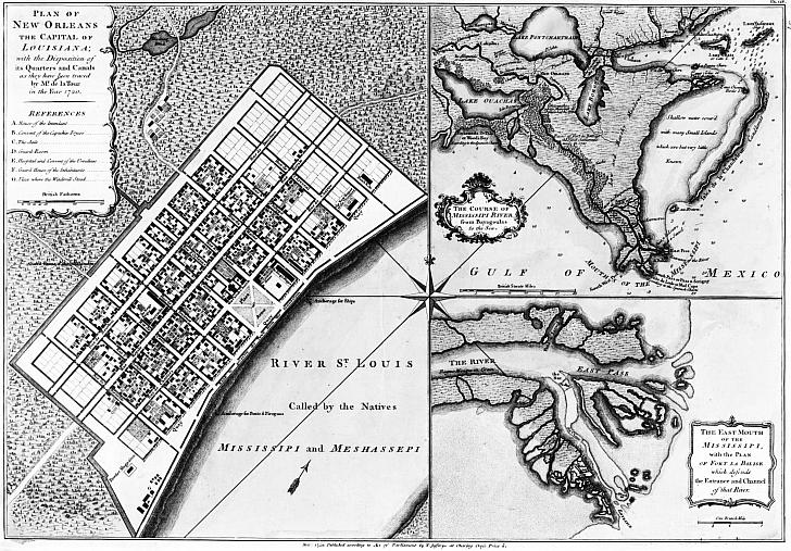
Bayou Road


CityPark/BayouRoad.jpg

“The oldest street is probably Bayou Road. When the whites first intruded into Louisiana they found it not altogether an untrodden wilderness. At the head of Bayou St. John, near the bridge which now spans that street at the foot of Esplanade Street, stood an Indian village. The moccasined feet of the inhabitants of this tiny settlement had beaten out a pathway by the shortest possible route through the swamps to the Mississippi...The white settlers found it a convenient route; they appear to have used it frequently even before the site of New Orleans was definitely decided upon, and so it has happened that later when new fauxbourgs were laid out it was a thoroughfare too well established to be changed, and it still runs its ancient course, across lots and through squares” – from John Smith Kendall's History of New Orleans (1922). The 1747 map shows the road to the bayou and the beginnings of the City of New Orleans.

 : :

Home
~Introduction~
~The Bayou, Road, Oaks, and Native Americans: 1400-1769~
~Plantation to Peristyle: 1770-1907~
~Expansion and Modernization: 1908-1928~
~The New Deal: 1929-1939~
~Children & Friends: 1940-2004~
~Rebirth: 2005-2010~
~The People Behind the Names: Donors, Benefactors, and Patrons~
~Acknowledgments~
Photo Gallery

The images in this book appear courtesy of the New Orleans Public Library (NOPL), Louisiana Digital Library (LDL), the Library of Congress (LOC), The Historic New Orleans Collection (HNOC), Pictometry International (PI), and D.C. "Infrogmation" May (DCM). Unless otherwise noted, images are from the author's collection.

A portion of the proceeds from the sale of this book is dedicated to Friends of City Park.

Contact Catherine Campanella