|
Lake Pontchartrain (Images of America) |
|
|
1798 Map |
||
|
|
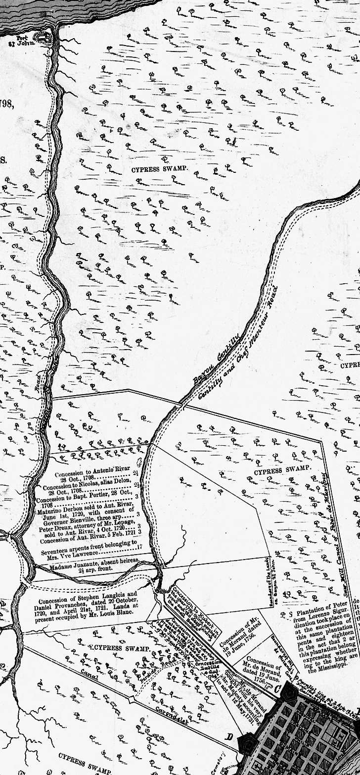 This 1798 map includes the route of the Carondelet Canal between the city and Bayou
St. John. (Courtesy Library of Congress). The turning basin/terminus of the Carondelet Canal at St. Peter and Basin
St. was near the present site of the Municipal Auditorium. Basin St. owes its name to the turning basin. In this undated photograph
we see oyster luggers docked at the basin. Oyster dealers remained on Rampart St. long after the canal and basin were covered
during the late 1920’s. (Courtesy New Orleans Public Library.)
|
Excerpts from New Orleans City Park (Images of America)
|
|
|
||