Lake Pontchartrain (Images of America)

1759 Map

LakePontchartrain/1759Map.gif

This 1759 map illustrates the short natural trail (left) through surrounding swamp which connects The Mississippi Rivers (and New Orleans) to Bayou St. John and the connecting waterways (top right) leading to the Gulf of Mexico.  

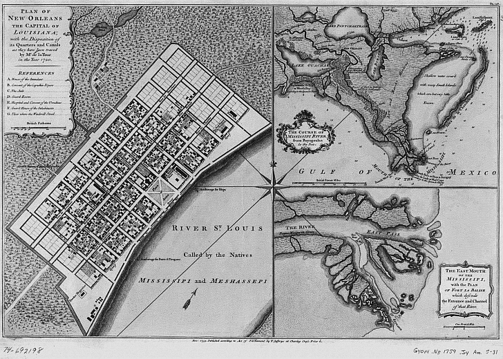
Iberville’s Native American guide showed him the ancient road through the forest which was used as a portage, allowing inhabitants to carry their canoes approximately one mile from the Mississippi River to Bayou St. John which led directly to Lake Pontchartrain. From the lake one could easily navigate to the Gulf of Mexico near Biloxi. (Courtesy Library of Congress.)


Other books
by Catherine Campanella:

Excerpts from New Orleans City Park (Images of America)

Home
Introduction
The Beginning
Milneburg
West End
Back to the Bayou
Lighthouses
Literature
Jazz
Change
War and Peaceful Pursuits
Life on the Lake
Photo Gallery
Acknowledgments
More Lake Pontchartrain History

Pages Recommended by Your Friends:

A portion of the proceeds from the sale of this book is dedicated to the Lake Pontchartrain Basin Foundation's efforts to rebuild the historic New Canal Lighthouse.

Contact Catherine Campanella