|
Lake Pontchartrain (Images of America) |
|
|
Land Reclamation |
||
|
|
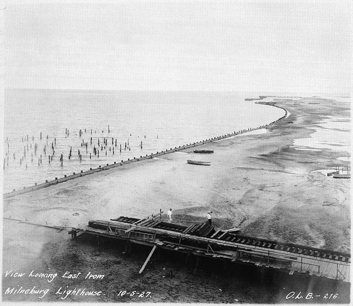 The photographer shot this
photograph from inside the Milneburg Lighthouse in 1927. Note the pilings from demolished structures . (Courtesy New Orleans
Public Library.) 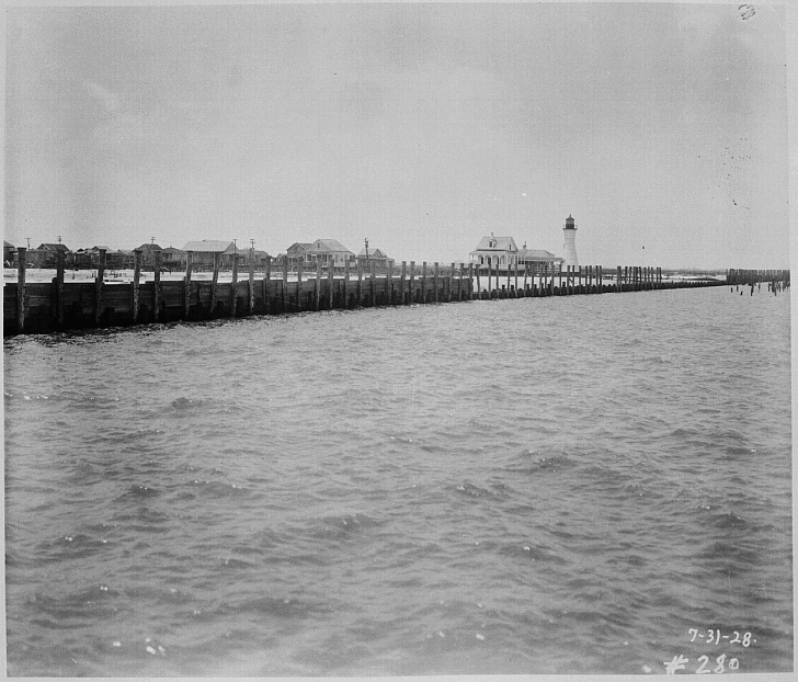 This 1928 photo illustrates
the amount of land that would be reclaimed near the Milneburg Light. The areas on the left of the bulkhead would become Pontchartrain
Beach amusement park. Note the camps along the original shore. (Courtesy New Orleans Public Library). 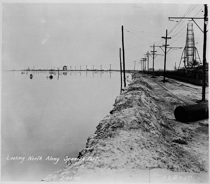 While work was being done at
Milneburg the area at Bayou St. John and Spanish Fort was destined for the same. In this 1928 view Spanish Fort amusement
park was still on the lake shore. Note the ferris whell on the right. (Courtesy New Orleans Public Library.) 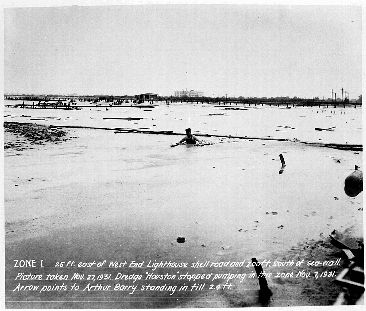 In West End the reclamation
project was also taking place. This caption reads "ZONE 1. 25 feet east of the West End light house shell road and 200
feet south of the seawall. Picture taken Nov. 27, 1931. Dredge "Houston" stopped pumping in this zone on November
7, 1931. Arrow [barely visible] points to Arthur Barry standing in fill 2.4 ft.” (Courtesy New Orleans Public Library.) 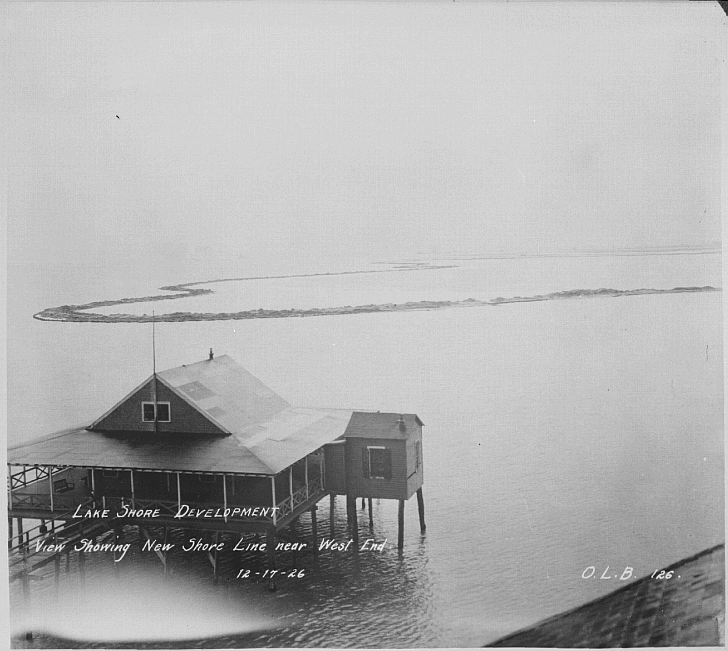 In this 1926 view of a doomed camp, the caption reads “LAKE SHORE DEVELOPMENT…View Showing
New Shore Line near West End…12-17-26…O.L.B. [Orleans Levee Board]. (Courtesy New Orleans Public Library.)
|
Excerpts from New Orleans City Park (Images of America)
|
|
|
||